
Most of these were found on ebay, some came from other White County sites. They are fun.
White County, Illinois
Most of these were found on ebay, some came from other White County sites. They are fun.
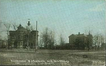 |
The Castle, located across from the courthouse, and the Webb-Hay house, from the Carmi City Park. It looks so much different. I guess these were taken about 1900. |
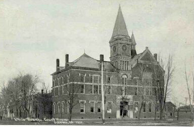 |
The Courthouse at Carmi, which was built in 1883. You can see the tower which was removed after being damaged in a storm about 1920. |
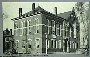 |
Another court house view, from the 1940's. |
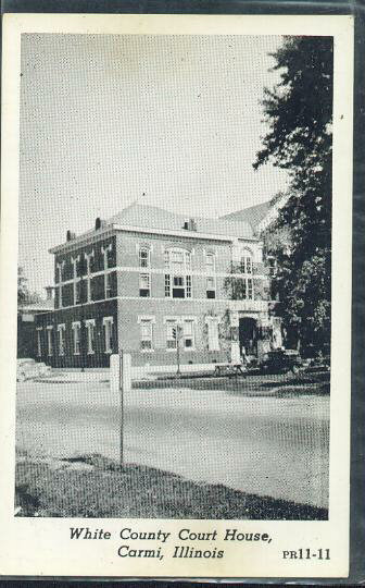 |
Not the prettiest courthouse photo, you can at least see the interesting windows in the courtroom. |
 |
The old bridge over the Little Wabash, pre-1913. |
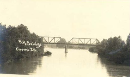 |
This one is called the railroad bridge. If so it is still standing. |
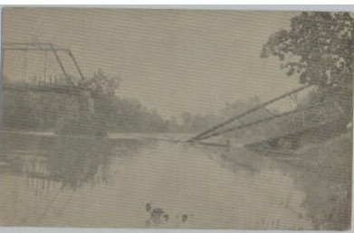 |
The pedestrian bridge was lost in the 1913 flood. |
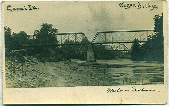 |
You can see the two bridges in this postcard--I knew some Bachmans over the years. |
 |
My guess is this photo was taken of the bridge during a flood, like the ones in 1898 or 1913. |
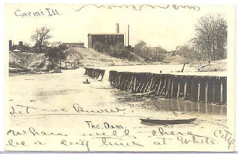 |
The old dam and city mill, owned by the Staley family. |
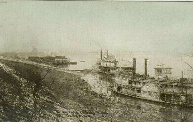 |
Supposed to be steamboats on the Wabash River at Carmi, but I don't see any landmarks to tie this to White County. |
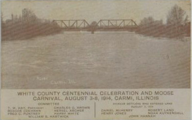 |
Not the best scan, but I got it from ebay. Note the committees for the Centennial. The 150th anniversary was not held until 1965, based on the establishment of White County, not Carmi's settlement. |
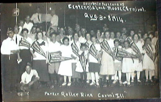 |
Speaking of the centennial, here's a photo of the event from Parker Roller Rink. |
 |
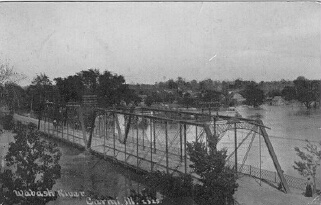
The bridge built after 1913. It was called the rainbow bridge, and was considered very attractive. It was replaced in the 1950s. |
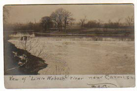 |
A little picture of the river. |
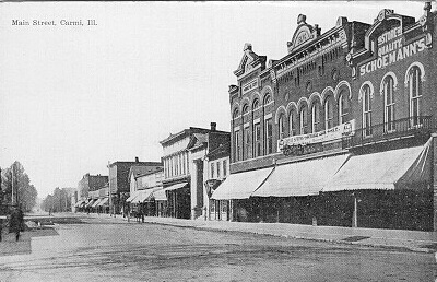 |
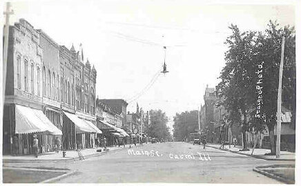
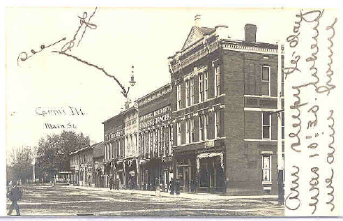
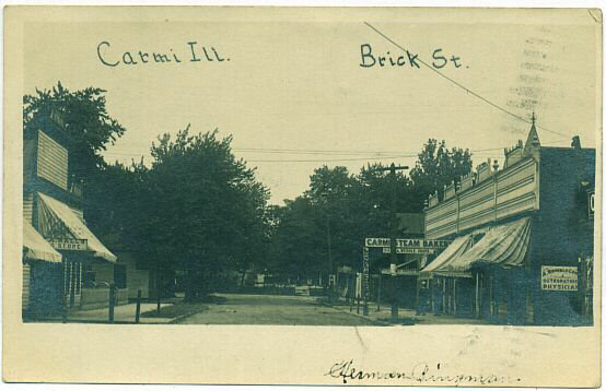
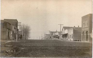
This a common postcard of the north side of Main Street in downtown Carmi. The Schoemann's store is now White County abstract, the building next to it was the L. Haas store and is now a museum, the next building burned in the 1970s, there's White County Bank with the columns down the street, etc. I think the photo was taken about 1910. Submitted by Laura L. Horton (Martin) elhzm@comcast.net. |
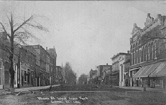 |
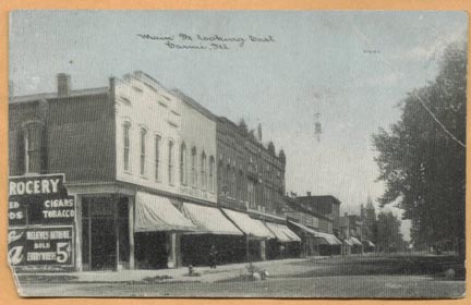
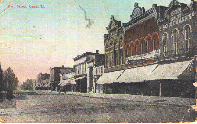
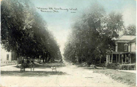
This postcard was taken about the same time as the one above but has more of the south side of Main. Most of the changes in Carmi have been on the "edges" of town, west and east Main street and Oak street. Submitted by Laura L. Horton (Martin) elhzm@comcast.net. |
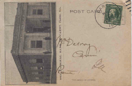 |
The National Bank, built about 1911. I thought about cropping this card but thought it was interesting as is. |
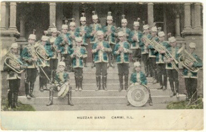 |
The Huzzar band on the steps of the Castle. |
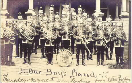 |
Looks like another shot from the same photo session. |
 |
A nice downtown picture. |
 |
The same basic view, from the Dr. Berry building looking east to the courthouse. I always thought this was a pretty old photo because the south side of Main was developed slower than the north, but I think the trees are hiding some buildings. |
 |
More downtown with the Hay Webb or First National Bank in the foreground. |
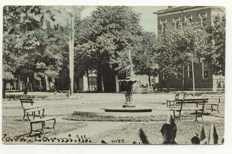 |
The city park, which would have been at the back of the photo above. |
 |
A colorized version. |
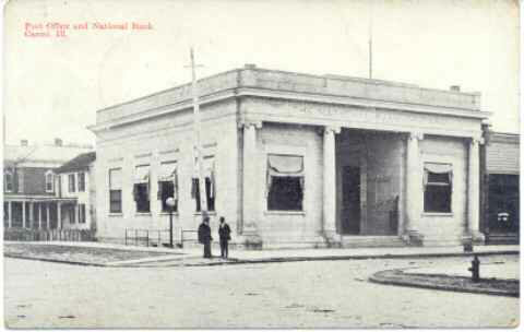 |
The original The National Bank building and Post office. It now houses the radio station and a resale shop. |
 |
The First United Methodist Church across from the bank. |
 |
First Presbyterian Church, located a couple of blocks north of the Methodist. |
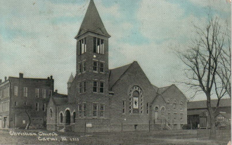 |
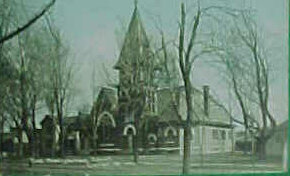
The old Christian church, located behind the Hay Webb bank on
Walnut
Street. It was torn down about 1964 after the church moved to the
corner of Plum and Bohleber. The site now contains the White County
Senior Citizens Center. |
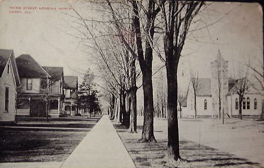 |
Third Street, with the old First Baptist Church, which I
remember as
Cherry Street General Baptist. It was replaced about 2001. |
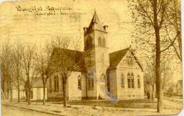 |
A close up of the Baptist Church. In the 1950s the Southern/Missionary Baptist congregation built a new church and sold this building to a General Baptist congregation, which occupied it until 2001. |
 |
This looks like Church Street before The National Bank was built. |
 |
West Main Street in 1906. Notice the brick italianate house on the right peeking from behind The National Bank in other cards. |
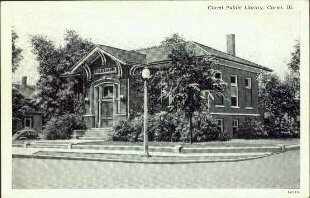 |
The Carnegie library from the 1920s. Not the best scan job. |
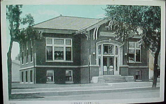 |
The library when it was very new. |
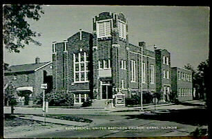 |
Emmanuel Church on North Third Street. It was built as a United Brethern or German church, and became United Methodist when the denominations merged. |
 |
Looking towards the railroad station. |
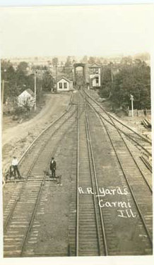 |
Railroad yards |
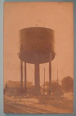 |
I sure don't remember this water tower. |
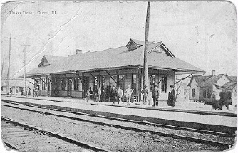 |
This was the union depot in Carmi. This depot was torn down in about 1985 by the city, after it was apparently damaged by use as a storage building. I have heard that the building was salvagable. It was several blocks off Main Street, but still at the edge of a commercial area. I think Carmi had two depots but need confirmation. Submitted by Laura L. Horton (Martin) elhzm@comcast.net. |
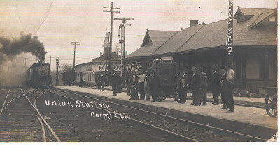 |
This photo was dated 1910 or 1911. |
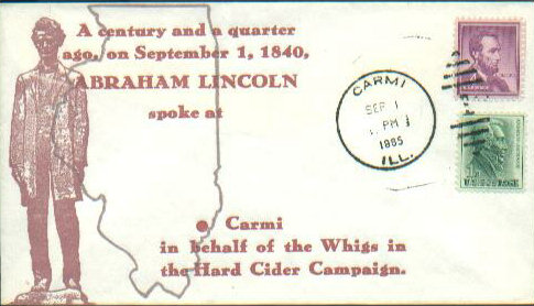 |
Not a postcard, but a cacheted envelope marking Lincoln's speech in Carmi. A marker near the First Baptist Church still stands near the spot were Lincoln spoke. |
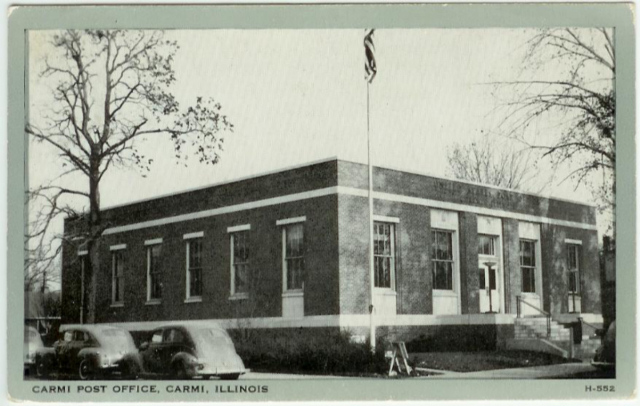 |
The new Post Office in Carmi, built in 1938. Its just down the street from my house. |
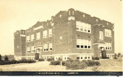 |
Carmi High School, on West Main Street. |
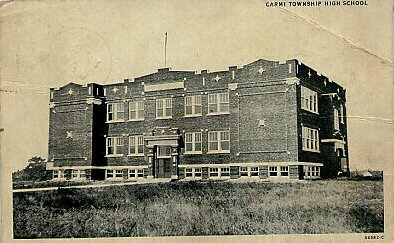 |
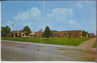
A more straight on view of the school. A new school was built in the 1950s. |
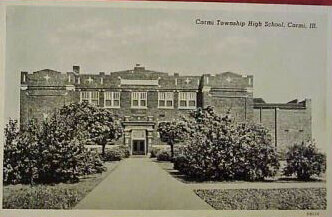 |
A gym or auditorium has been added in this picture. |
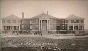 |
On the far east side of Carmi stood the county infirmary, originally the poor farm, and late the county nursing home. It was torn down about 1990 after medicare started figuring the age of a facility into their reimbursement formula. |
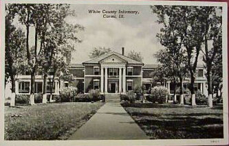 |
Probably from the 1940s. You can see the whitewashed bottoms of the trees, work probably performed by residents. |
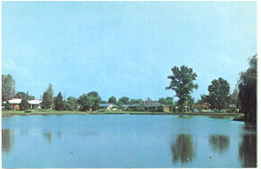 |
A 1960s view of Griffith Lake, on West Oak Street. The nice homes are on the north side of the lake. |
 |
This view of the Ratcliff Inn was part of the same postcard as Griffith Lake, showing 1960s improvements to the city. |
 |
Another 1960s view, of the Carmi Township Hospital which was opened around 1952. A skilled nursing unit as been added to the west end of the structure, which was covered with stucco a few years ago. It was sold to Cornerstone Healthcare Systems in 2000. |
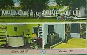 |
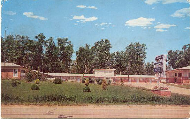
A lousy copy of a postcard from the Carmi Motel. It hasn't changed much at all. |
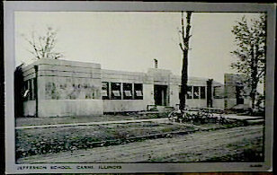 |
Jefferson School on the north side of Carmi. I assume it is from the 1940s. |
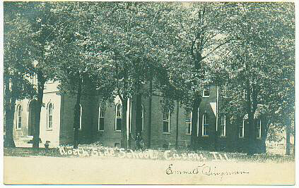 |
The school building which predated Jefferson. |
 |
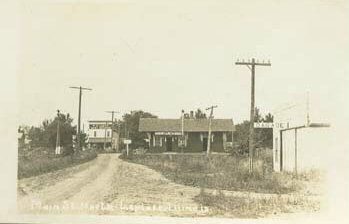
Finally, not Carmi. This is Phillipstown from around the turn of the century. |
 |
Enfield's Ecko motel and restaurant from the 1950's. It was built by the Eck family. |
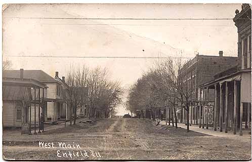 |
Downtown Enfield, looking west from what is now Highway 45.The Opera House is the big building on the right, and the two chimneys belong to the funeral home. |
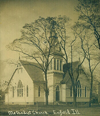 |
The old Enfield Methodist church, which was torn down about 1969, when the Methodist and Presbyterian congregations merged. Only the brick Presbyterian church survives. |
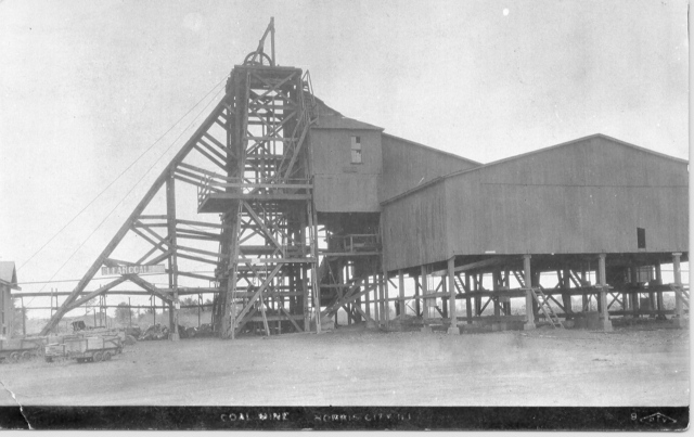 |
The Norris City Coal Mine, long gone. Gotta find some more for Norris City. I don't search for them. |
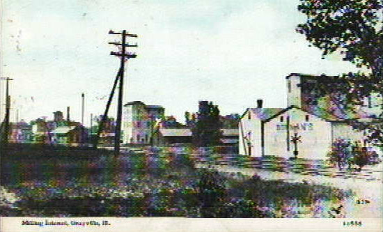 |
This photo of the Grayville mills is not the greatest. |
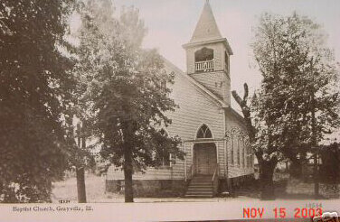 |
Grayville's Baptist Church. |
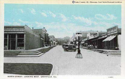 |
Downtown Grayville, looking from the River to the highway/. The building in the left fourground is a bar now, many of the buildings are still there. No parking in the middle of the street. |
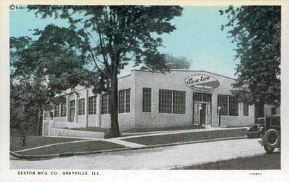 |
What I remember as the Spartan Plant at Grayvllle. |
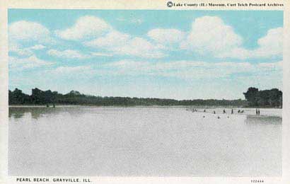 |
Pearl Beach at Grayville. There was also an amusement park in an island in the Wabash River. Floods have caused the channel to move so the town has limited river access. |
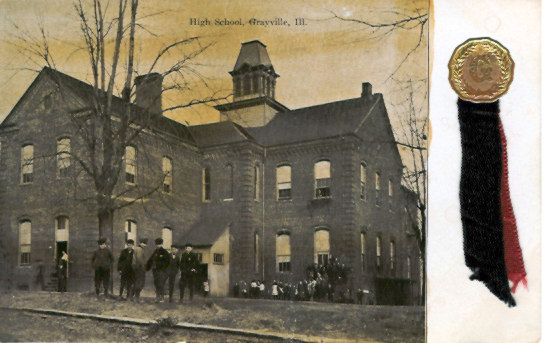 |
I don't remember this Grayville school. The "old" high school is in disrepair. The school district has consolidated into a smart complex on Highway 15 at the west edge of town. |
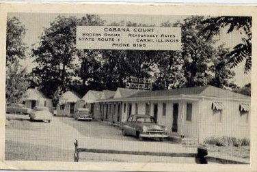 |
Back to Carmi. This motel was finally cleared in the 1980s. |
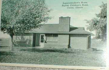 |
I have several shots from the Baptist Children's Home, located on the SW edge of town. It was started as an orphanage about 1917, is now a home for children with emotional problems. |
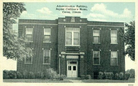 |
Another Baptist home building. |
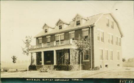 |
The original boys ward at the Childrens home. Today the residents live in family-sized groups with house parents and the old ward buildings are used for offices and activities. The residents attend Carmi schools. |
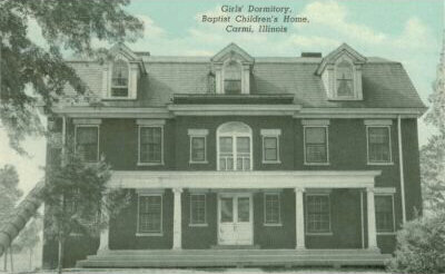 |
The original girls dormitory. |
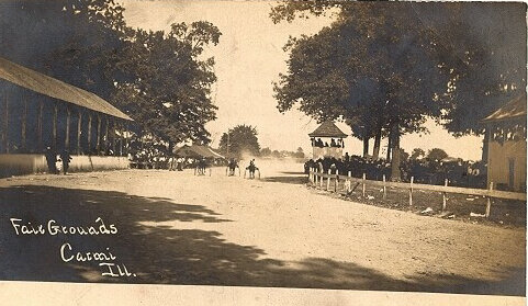 |
The White County Fairgrounds are on the west side of Carmi, in the country when this postcard was issued. |
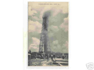 |
A card of the Storms Discovery Well, listed as Carmi but more likely between Crossville and the New Harmony bridge. Probably from around 1939. |
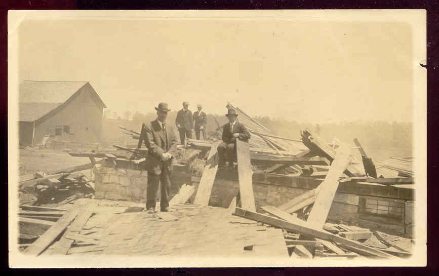 |
This ebay postcard is supposed to be from a tornado in Carmi. My guess is that it would be some of the destruction from the 1925 twister. |
The Coordinator for the White County, Illinois ILGenWeb page is Cindy Birk Conley
Updated 8/8/2011
Copyright ©2003 by Laurel Crook and Cindy Birk Conley all rights reserved. For personal use only. Commercial use of the information contained in these pages is strictly prohibited without prior permission. If copied, this copyright notice must appear with the information.